Drawing lines on water
Territories and borders demarcated by nation-states are most authoritative but they are not the only borders that exist. There are other invisible borders that belong to communities

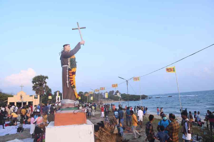
A view of Katchatheevu island in Sri Lanka.
An uninhabitable 163-acre island called Katchatheevu in the Palk Strait comes to life every year for a couple of days in March. This Sri Lanka-administered island hosts the annual festival at St Anthony’s Shrine, the revered patron saint of the seafaring communities belonging to India and Sri Lanka.
However, Katchatheevu is not emblematic of cross-border socio-religious bonhomie only. It also lies at the heart of a festering dispute between India and Sri Lanka. Every year, an increasing number of Indian fishermen are arrested and their boats seized by the Sri Lankan navy on account of the violation of the maritime boundary. The same is also true for Sri Lankan fishermen in Indian waters.
Katchatheevu is a legacy of the Empire that was handed over to India and Sri Lanka. In 1974, the median line was followed to settle maritime boundaries between the two nation-states; Katchatheevu was marked on the Sri Lankan side. India’s decision then to settle the boundary dispute and accept Sri Lankan sovereignty over the island was seen as a befriending gesture for a more stable and favourable South Asian environment. In 1976, a second agreement defined the nature of sovereign rights and exclusive jurisdiction along this settled boundary.
Why then does the fishers’ dispute continue? In this case, the maritime boundary, which is an extension of the state territory, disrupts a more traditional fishing ground of the seafaring communities.
Territories and borders demarcated by nation-states are most authoritative. But they are not the only borders that exist. There are other psychological, invisible borders that belong to communities. Conflicts often arise when the edges of these borders do not overlap. Take, for instance, clandestine migration in South Asia. Despite hard borders, migration continues because traditional routes of kinship among communities precede and bypass state demarcations. For the fishermen, the state boundary is an imposition, preventing them from accessing territory that is part of their history, culture and livelihood.
How does this mismatch of boundaries lead to border violations? First, fishermen often go beyond the maritime borders without knowing where the borders actually are. Maritime borders are characteristically different from demarcated land borders. Second, resources are fluid and agnostic to political boundaries. Often, Indian and Sri Lankan fishers cross territorial waters while chasing a good catch. Third, domestic politics in both countries play a role in not putting the maritime boundary into practice. The politics of Tamil Nadu fiercely supports the cause of coastal seafaring communities. The Indian government has also incentivised mechanised bottom trawling techniques for a higher catch. The Sri Lankan side has rich fishing grounds and the preoccupation of the fishers from northern Sri Lanka with the long civil war allowed the Indian side to intrude into Sri Lankan waters. As Sri Lanka recovered from the civil war and fishing became active in its northern waters, vigilance against Indian fishermen increased, resulting in incidents of seizures, arrests, and killings.
Udayan Das is Assistant Professor, St Xavier’s College (Autonomous), Calcutta